
I live in a great city-the Emerald City- Seattle, Washington. Living here 32 years is more than half my life. I started life as a New Englander, growing up in a Connecticut suburban town with a couple elementary school years in Buffalo, college in Schenectady, New York, and Massachusetts where I started my professional career in the Boston Metro area before moving to Seattle. After three decades, I call this place home. It didn’t take 30 years to say that but it definitely took awhile. Now, I can’t imagine leaving. Living in this wonderful part of the world is enhanced by living in a great neighborhood.
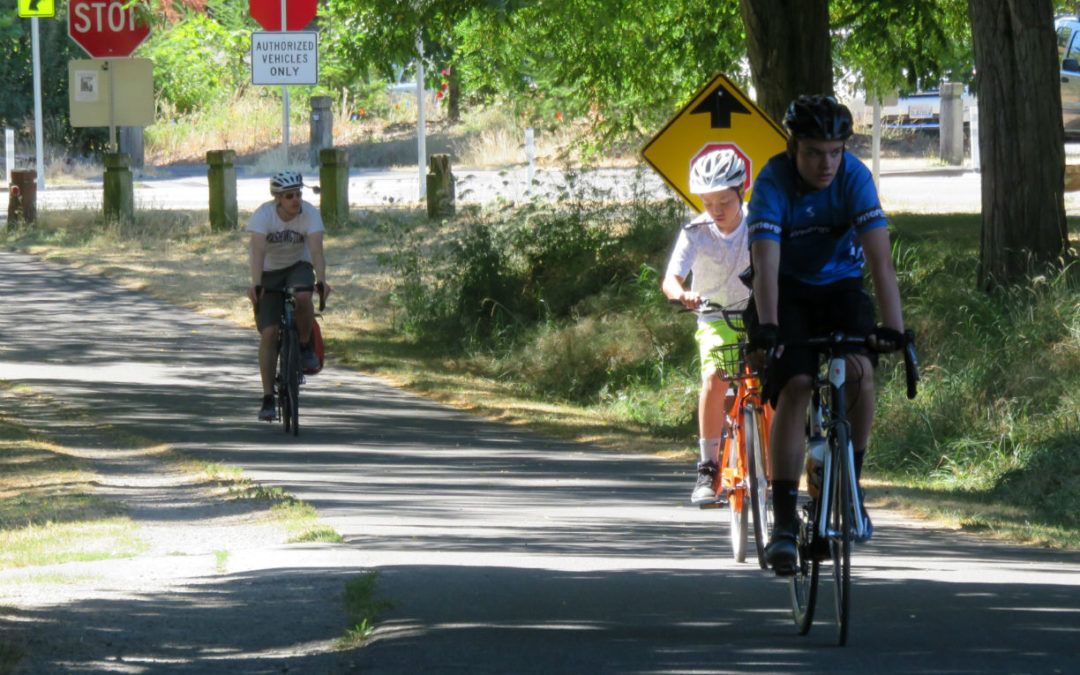
Biking on the Burke Gilman Trail on a mid-summer’s day
What makes where I live so special? My uncle taught me the first rule of real estate is location, location, location. It’s the neighbors and the location! I live one and a half blocks away from the Burke-Gilman Trail a 20-mile former railroad grade that stretches from the City of Bothell at Lake Washington’s north end to Seattle’s Ballard neighborhood, connecting with the King County trail system. At my trail access is a compact commercial area with City People’s Mercantile a member of the True Value Cooperative, Katterman’s Pharmacy, Sand Point Grill, and other small retail establishments. One-half mile away by walking, biking, or driving is Metropolitan Market-Sand Point a full service grocery store.
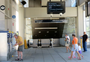
Mid-Day at the UW Link Light Rail
The Burke-Gilman Trail has easy bikeable access to the University of Washington’s Link Light Rail station with trains running from 5 a.m. and 1 a.m. daily to downtown and SeaTac Airport. Service is every 6 minutes during rush hour, every 15 from 5 a.m. to 6 a.m. and from 10 p.m. to 1 a.m. and every 10 minutes at all other times. Since March 2016, the Link’s most northern stop at the University of Washington on the north side of the city-splitting ship canal has been a commuting game changer. Biking to the station takes me 20 minutes. I lock my bike and hop the train to get downtown. It can take me as little as 35 minutes from my house to my Pioneer Square office for a $5 round trip. Considering during rush hour it can take up to an hour in an automobile to get downtown, plus a minimum $14 daily parking fee, the Link is a bargain in time and money! The bus is the same price as the train, but takes almost an hour to get downtown, since it gets stuck in commute traffic. LINK’s also easy access to the airport without getting caught in downtown I-5 traffic.
King County Metro busses # 62, #74 and #75 all serve my neighborhood with bus #75 providing simple, walkable access to the University of Washington’s Link Light Rail station, too. Would more frequent bus service on Sand Point Way be a benefit to my commute? Absolutely! Thankfully, I’m willing to bike in almost any weather!
Grades from Walk Score
Today, data also drives information and decisions. Walk Score and AARP’s Livability Index are two great tools to research and evaluate any U.S. real estate address. Walk Score, now owned by Redfin a full-service real estate firm, computes a walk score, transit score, and bike score using mathematical algorithms for addresses across the United States. According to the founders,
“The Walk Score algorithm awards points based on the distance to the closest amenity in each category. If the closest amenity in a category is within .25 miles (or .4 km), we assign the maximum number of points. The number of points declines as the distance approaches 1 mile (or 1.6 km)—no points are awarded for amenities farther than 1 mile. Each category is weighted equally and the points are summed and normalized to yield a score from 0–100. The number of nearby amenities is the leading predictor of whether people walk.”
The walking distances to my local amenities are: City People’s Mercantile-0.2 miles, Katterman’s Pharmacy and Sand Point Grill-0.3 miles, and Laurelhurst Elementary School and Park-0.6 miles. All are incredibly walkable destinations. University of Washington’s Seattle campus is 2 miles away and University Village, Seattle’s premier shopping center is 1.5 miles away and both are easily bikeable. (Now if University Village would only add more bike parking!) Based on a maximum score of 100, my Walk Score is 57 designated as somewhat walkable, Transit Score is 52 with good nearby public transportation options and Bike Score is 60 with very steep hills and some bike lanes.
All of these scores are low by my summertime standards, but probably accurate for a cold, rainy, winter day standard. In the summer it’s easy to hop on my bike to pick up a few items at Met Market or walk to City People’s. The bike score is low for any destination along the Burke-Gilman Trail and absolutely too high, if a steep hill is on my route.
AARP’s Livibility Index Scores
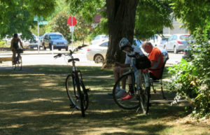
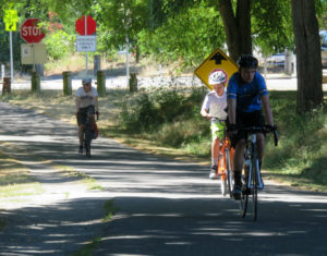
A Break on the Burke-Gilman Trail
AARP originally created their Livability Index for seniors, but now advertise it as “Great Neighborhoods for All Ages.” What is good for seniors is good for children! Safe streets, easily available and accessible stores and public transportation, a healthy environment, employment opportunities, possibilities for civic engagement and entertainment, and housing affordability benefit all ages, not just seniors. AARP’s Livability Index is a web-based tool that scores health, environment, transportation, neighborhood, engagement, opportunity and housing. These seven category scores are calculated both cumulatively and individually to contribute to well-being or livability score. Policies, studies and statistics that support and further define each livability factor are expanded under each category. Each category’s individual score can be dialed upwards or downwards in real time by the user to place higher or lower emphasis on a specific well-being attribute. As an example, access to hospital or doctor facilities (Children’s Hospital is 1/2 mile away) may be of utmost importance to one family, while a walkable neighborhood and easy transit access may be the top priority to another family. Housing affordability and job opportunities may be the most important issue for another and be dialed higher or lower individually. Scores are rated in thirds with green scores of 67 to 100 as best, 34 to 66 as middle ranked and less than 33 as below average.
My neighborhood ranks in the top third in the health and environment categories. We have superior access to parks and recreational facilities, excellent air quality, and comparatively low smoking rates. With Laurelhurst Park and Burke-Gilman Playground being only one-half mile away, I also live 1.5 miles from the 350-acre Magnuson Park with beach access, trails, sports fields, P-Patch gardens, and a playground. Our transportation, neighborhood, engagement, opportunity, and housing categories are in the middle third ranking and our neighborhood has no scores in the bottom third. Housing is our lowest livability score at 37 mostly due to Seattle’s housing affordability crisis. Seattle area housing and rental costs continue to skyrocket.
Both Walk Score and AARP’s Livability Index rank my neighborhood similarly and slightly above average for livability and walkability. What are your scores?
Kathryn Gardow, P.E., is a local food advocate, land use expert and owner of Gardow Consulting, LLC, an organization dedicated to providing multidisciplinary solutions to building sustainable communities. Kathryn has expertise in project management, planning, farmland conservation, and civil engineering, with an emphasis on creating communities that include food production. Kathryn’s blog muses on ways to create a more sustainable world and good food!